


| Version 5 (modified by , 10 years ago) (diff) |
|---|
Contents
Add geolocations to Trac tickets
Notice: This plugin is unmaintained and available for adoption.
Description
This plugin geolocates issues and displays them on a map using GeoServer and OpenLayers. A location field is added to the ticket using the CustomFieldProviderPlugin which is then geolocated using Google's API via geopy. A map is displayed alongside the ticket using the TicketSidebarProviderPlugin.
Bugs/Feature Requests
Existing bugs and feature requests for GeoTicketPlugin are here.
If you have any issues, create a new ticket.
| defect |
2 / 2 |
||
|---|---|---|---|
| enhancement |
1 / 2 |
Download
Download the zipped source from [download:geoticketplugin here].
Source
You can check out GeoTicketPlugin from here using Subversion, or browse the source with Trac.
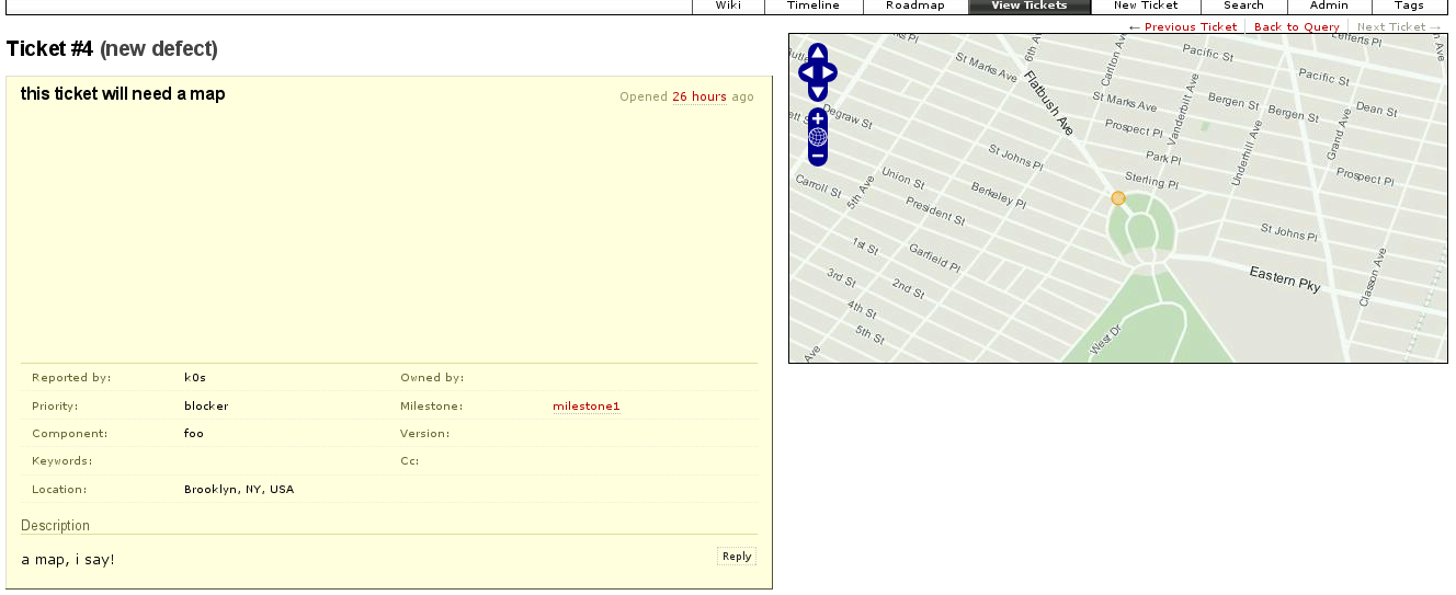
Example
A screenshot of the plugin in action:

Demo
A demo of this in action may be available at http://geotrac.demo.topplabs.org/
Recent Changes
- 12984 by rjollos on 2013-04-19 16:30:50
-
Refs #7262: Point
setup,pylink to TracSqlHelperScript0.11directory rather thananyreleasedirectory.
- 7768 by k0s on 2010-03-10 01:23:53
-
check to ensure db is not none before commiting; honestly, i dont understand any of this :(
- 6785 by k0s on 2009-10-21 18:59:21
-
pass in doc keyword; see http://trac.edgewall.org/ticket/8763#comment:2
(more)
Author/Contributors
Originally developed at The Open Planning Project
Author: k0s
Maintainer: none (needsadoption)
Contributors:
Attachments (1)
- geotrac-example.png (296.8 KB) - added by 16 years ago.
Download all attachments as: .zip